HOME / PROGRAMS AND PROJECTS
Environmental Rehabilitation Program for Wadi Hanifa
RCRC adopted the protection, rehabilitation, and development of the Wadi Hanifa region, and established the project as a priority due to the great importance of this region and the desire to attract investment, and because the valley, with its vast and ramified area from north to south of Riyadh, is capable of being the ‘green lung’ of the city and a natural outlet for its residents.
The strategic location of the valley
Since ancient times, Wadi Hanifa has been a habitat for successive civilizations to settle in it due to the abundance of its natural resources of water, wildlife, and rich soil, which in its entirety constituted an environment suitable for agricultural and pastoral activity.
The location of the valley in the middle of the Arabian Peninsula also constituted an important trade route corridor at that time which linked Mesopotamia to the south of the island and the Hijaz and linked the regions of the north of the Arabian Peninsula to its south and was a meeting place for the human civilization.
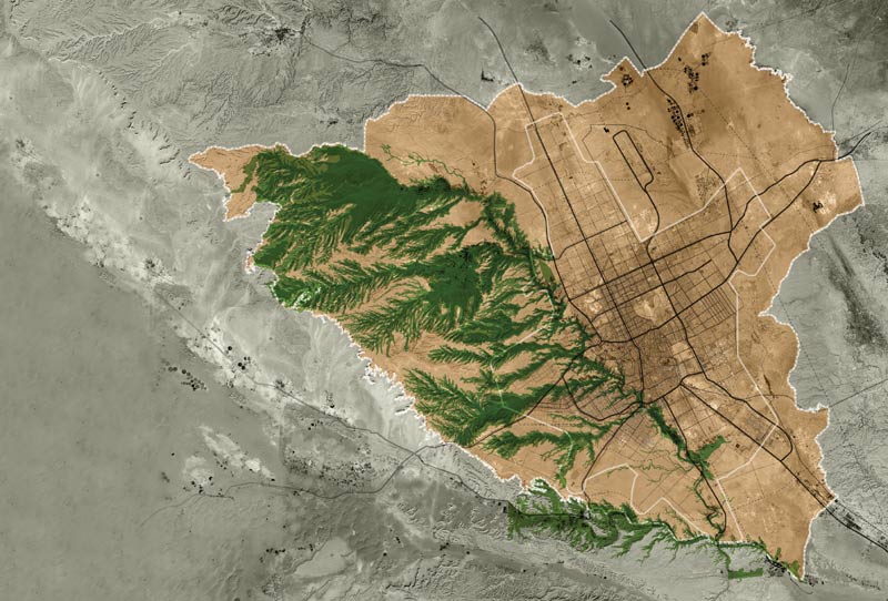
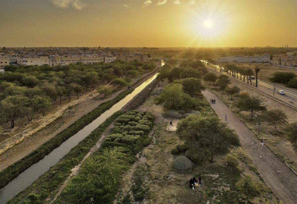
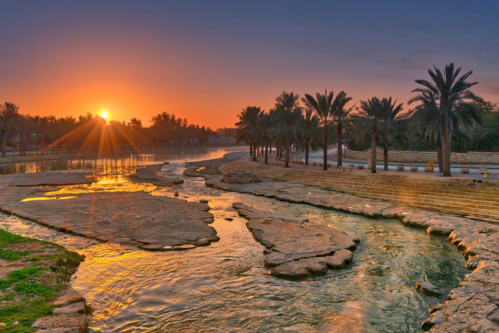
Wadi Hanifa descends from the heights of Al-Haisiya in the north, penetrating the city of Riyadh to its southeast at Al-Hayer, with a length of 120 km, and then empties into Fiafi Al-Sahba in the south. Its depth varies from 10 meters to 100 meters, and its width varies from 100 meters to nearly 1,000 meters wide.
Wadi Hanifa represents a natural drain for torrential waters and rains for an area estimated at 4,000 square kilometers of the open areas surrounding it, where natural tributaries of over 40 valleys and reefs flow into it, the most famous of which from the west being Al-Abitah, Al-Amariya, Saffar, Mahdia, Bir, Laban, Namar, Al-Awsat, and Laha, and from the east, Eisen and Batha. The amount of water that flows into the wadi daily is about one million cubic meters, including ground water and treated water from treatment plants.
The beginning of the deterioration and environmental imbalance of the valley
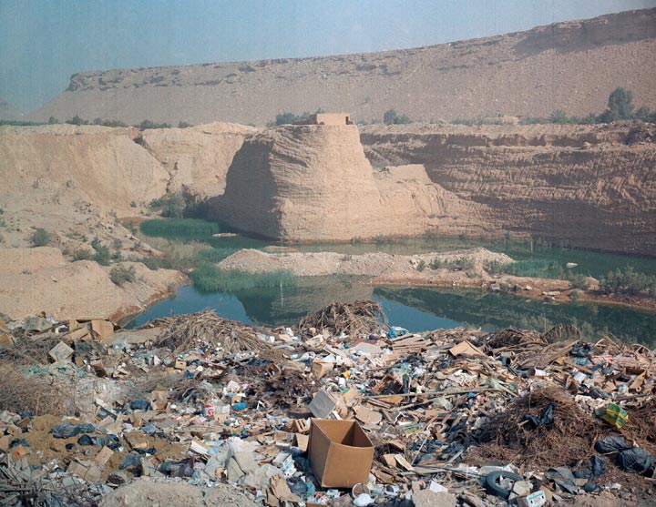
The valley continued to maintain its environmental balance between its compensatory capabilities and the impact of human settlement along its banks until the beginning of the AH nineties of the last century after which the valley deterioration began, caused by the great urban development of the city of Riyadh and the environmental impact on large areas of the valley floor caused by soil transport activities from quarrying and industrial activities.
This led to an environmental imbalance in the valley, as its topography and natural formations were subjected to a major change that led to the deterioration of soil construction and the erosion of the valley’s natural edges and the formation of potholes and grooves. Large parts of the valley also became a dumping ground for waste of all kinds, including construction waste, and industrial activities.
An ambitious plan to reverse years of deterioration of the valley
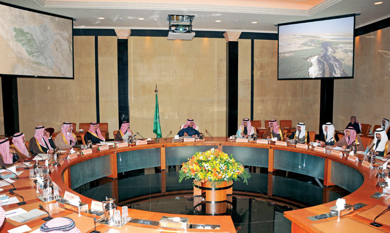
RCRC decided in its third meeting in 1408 AH to consider the valley an environmentally protected area and a special development area under its supervision to address the deteriorating situation in it. The Commission also approved in its second meeting in 1415 AH a comprehensive plan for the rehabilitation of the valley and its tributaries, based on several policies, regulations, procedures, and actions aimed at stopping the environmental deterioration of the valley through addressing the status of human uses and activities that violate the environment. The most prominent of these measures are:
- Transferring the quarries from the valley area to other areas outside the city, transferring most of the existing industrial activities in the valley outside it, stopping the work of earthmoving, limiting the construction of new lines for public utilities crossing the valley, the permanent evaluation of its environmental indicators and the preparation of controls regulating the various activities in it.
- Determining the torrential streams of the main valley and its tributary valleys. For this purpose, spatial charts have been prepared showing the width of the torrential streams and the valleys’ topology, as well as fragmentation controls for the holdings located in the valley area, in addition to models for building fence designs that are consistent with the environment of the valley and with the traditional building patterns in the region.
In the year 1423 AH, RCRC prepared the comprehensive plan for the development of Wadi Hanifa to be a comprehensive planning and organizational reference that aims to control all existing and future human activities in the valley, according to environmental considerations that serve the valley’s natural environment and to remove damage, and to employ the opportunities and capabilities that the valley offers.
The comprehensive plan includes a plan for managing water resources in the valley, an environmental classification scheme, a land use plan, and an executive plan that includes programs and controls for rehabilitation, development, and management proposed in the valley, as well as projects to rehabilitate the valley to carry out its natural role, restore the environmental balance of its surroundings, benefit from its components and natural resources, and prepare its recreational facilities for investment.
Environmental rehabilitation project for Wadi Hanifa
The environmental rehabilitation project of Wadi Hanifa formed the basis for the rest of the development projects in the valley. The project was implemented starting from the Al-Alb Dam in Al-Diriyah in the north to the town of Al-Ha’ir in the south, with a length of 80km.
The project has the following main objectives:
- Restoring Wadi Hanifa to its natural state as a drain for rainwater, torrential rains, and perpetual flowing water coming into the valley from several sources from the city, and reinstating the natural environment to make it free from pollutants and obstacles that prevent natural compensation mechanisms in the valley, and protecting the plant and animal ecosystem. In addition to enhancing existing facilities and services, to improve the wadi environment.
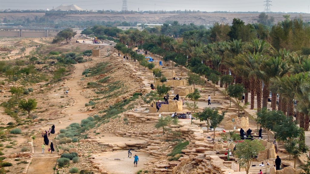
- Transforming the valley as an open area available to residents of the city by adding appropriate roads, pathways, and facilities.
Three water levels
The project included the leveling and management of watercourses, taking into consideration the three different sources of flowing water discharge, namely: perennial water that feeds in from the city’s groundwater reduction networks; flood water from drainage networks; and treated water from treatment plants.
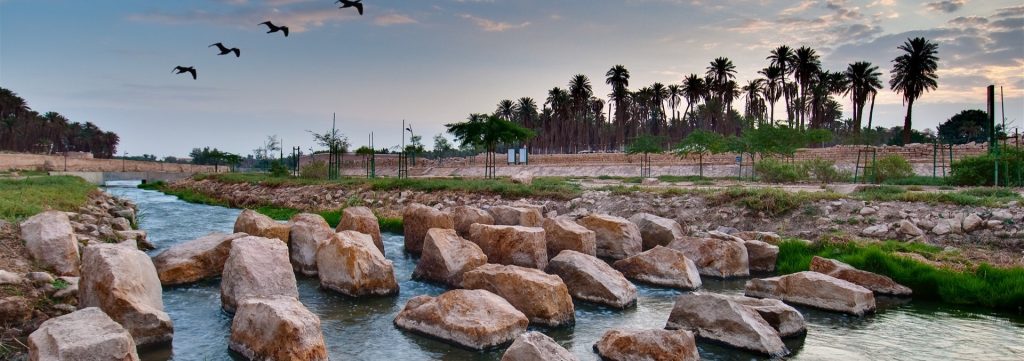
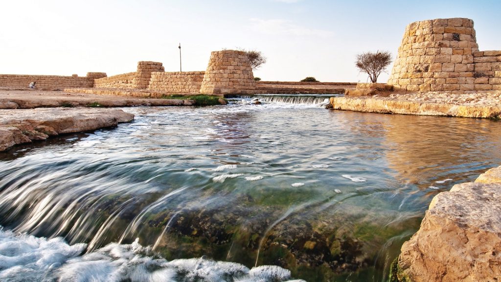
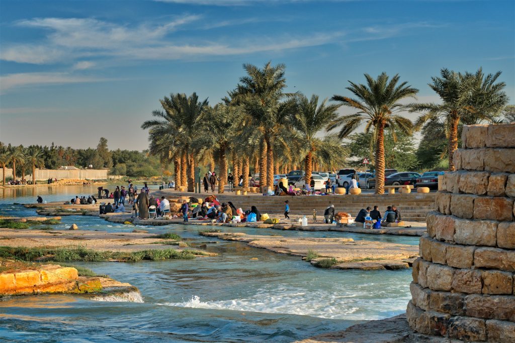
An open channel for permanent flowing water was prepared, supported by rock formations and weirs to help treat the water and maintain its drainage capacity throughout the year, with a length of 57 km, and with a relatively wide width that reaches six meters across in some parts and a depth of 1.5 meters.
The project also reinstated managed channels for seasonal torrents that run in the valley during the rainy seasons, as the valley’s belly was flattened with a permanent inclination towards the south, and an occasional inclination towards the permanent channel.
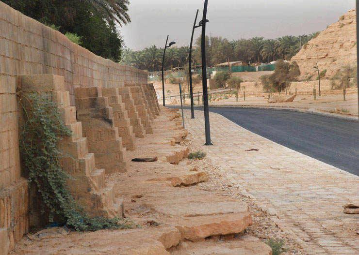
The edges of the valleys have been reinforced at critical places, and the existing services and facilities in the valley have been strengthened to withstand flooding.
Floods due to climatic cycles occur approximately every 50 years, and given that they are rare, wadi management is focused on stopping the encroachment of private holdings onto the streams of torrents, and the removal of backfills from the valley floor and reefs feeding into it.
Natural water treatment system
To combine the functional requirements of the project with the strict environmental standards set by the comprehensive plan for the development of the valley, the environmental rehabilitation project adopted a new mechanism for treating running water in the valley, based on a natural, non-chemical treatment system. The aim was to create an environment in the watercourse that supports the presence and reproduction of micro-organisms, which derive nourishment from the organic and inorganic components in the water.
A natural water treatment system was chosen for its low environmental impact and low operating cost. The system uses sunlight and oxygen, which help the growth of micro-organisms and algae, which in turn feed on the various organisms scattered in the water, starting with bacteria, and ending with fish and birds. The project contributes to benefiting from the water drained into the valley throughout the year, by treating it and reusing it safely for agricultural, industrial and urban purposes.
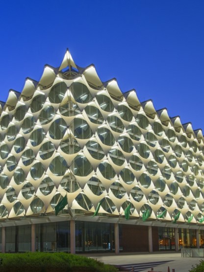
BIOLOGICAL TREATMENT PLANT
In the same context, the valley floor adjacent to the ‘Algeria Square’ in the southern part of the city of Riyadh was chosen to host a Biological Water Treatment Station, which covers an area of more than 100,000m2, and aims to increase water flow and increase oxygenation, to contribute to the growth of living organisms that reduce pollutants in the water.
The water treatment station is characterized by its high capacity because it contains many weirs in groups and basins connected to the main water channel in the station. These comprise 140 weir cells, each cell being 30 meters long, six meters wide and two meters deep. Every weir cell is equipped with electric aeration systems, and a weir basin to increase the efficiency of treatment and thus increase the percentage of dissolved oxygen in the water.
Corridor for public services
The project re-coordinated public utilities in the vicinity of the valley to improve their position in accordance with the new situation and its sensitive environmental requirements, which involved converting all overhead utility lines into land lines, in coordination with the authorities responsible for them.
An area that extends along the valley, parallel to local roads, acts as a corridor for local utility lines. The corridor is flanked by paths with public services such as drinking water, charging and telephone points, identified through detailed maps.
Environmentally friendly methods
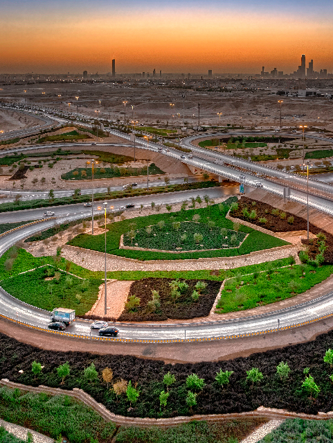
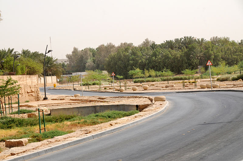
The project included upgrading the highway with a length of 43km, starting from the north road to Mansourieh Road, with 22 bridges and crossings at the intersection of the road with the canal, and various warning, indicative and directive traffic signs, amounting to more than 730 panels that contribute to directing visitors to the valley.
Ferries were implemented on the road to reach the secondary valleys and some entrances to the farms that are located above the flowing water channel, leading to improvement in communication points between the city of Riyadh and the valley.
The work of improving road networks included road upgrades and pedestrian walkways, the installation of 2,500 lighting poles, in addition to 600 lighting units for bridges and separate areas of the valley, in addition to the implementation of chapels in places where there are no mosques, and the implementation of 30 toilets distributed along the valley, publication sites, parking lots for 2,000 cars, and the preparation of kiosks and waste containers.
Footpaths
Pedestrian paths extend for a length of 47 km in the most prominent aesthetic areas along the valley, in addition to paved paths with a length of 7.4 km. Paths were in the vicinity of beautiful, wooded rock formations and waterways, considering accessibility to these paths from parking lots.
Pedestrian paths are designed in such a way to allow pedestrians, parents with strollers and the disabled to move unheeded, protected by shoulders of rocky formations that act as delineators for the paths and equipped with resting places with seating and areas for rest or picnics.
Vegetation returns to the valley
To achieve an environmentally sustainable valley, the project involved a process of revegetation of Wadi Hanifa across a number of areas, the most prominent of which are: replanting of plants that were previously components of the valley in the past, and an increase in superficial and subterranean planting to preserve the natural capabilities of the valley’s own water.
Replanting included 30,000 desert trees, 7,000 palm trees, and 2,000 desert trees such as Acacia, Samar, and Peace trees, and 50,000 bushes cultivation from seeds and ready-made seedlings.
OPEN PARKS
The environmental education and rehabilitation projects include the following features:
- A park that featuring pedestrian walkways of 2 km, and designated areas for picnickers.
- Wadi Hanifa Park, which has 27 areas for hikers, and a pedestrian path with a length of 5.6 km.
- The Eid Prayer Park in Sultan, which includes pedestrian paths with a length of 2.3 km, including wider bridleways for agricultural access.
- A park in Ateeqa, which contains 52 designated rest areas and pedestrian walkways with a length of 1100 meters.
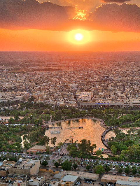
- The Stone Dam Park, featuring a lake with an area of about 10,000m2 with a length of two meters. The perimeter of the dam is paved with pedestrian access with a length of 2.8 km, and several designated areas have been implemented on the lake.
- Al Masanea Lake Park, which includes pedestrian paths with a length of 3.5 km, and 22 designated areas with an area of 40,000 m2 by the lake.
Al Jazaa Park, which includes pedestrian paths with a length of 2.8 km, and 27 stone paved rest areas for hikers.
Valley guide system
The guidance system at Wadi Hanifa contains 730 panels to guide visitors and share environmental and natural features and services.
Protecting historical sites
The authority enacted urban controls for the development of historical sites in the valley that aim to preserve the wadi’s urban characteristics and develop them culturally, environmentally and socially, linking them to the neighborhoods surrounding the valley, protecting historical areas from the extension of private ownership, and employing historical and urban specificities, as well as direct maintenance work for afforestation, coordination, and maintenance planning of the valley and the voluntary participation of individuals and institutions.
Specifications for property fences
Designs and specifications were developed for the walls of the existing farms, especially the parts visible to the valley’s visitors or overlooking the valley floor, to achieve the required homogeneity between the natural elements of the valley. Through these measures, the authority aspires to preserve the traditional architecture in the valley, and to preserve the ancient heritage architecture, with an emphasis on the roles that owners and citizens assume in preserving this urban heritage.
Environmental controls
The authority has established environmental controls that provide a foundation for environmental renewal, environmental health and quality of life at Wadi Hanifa, to monitor and evaluate the impact of development and water, air, and soil pollution on the environment, in addition to increasing environmental and cultural awareness among the population.
Geographical database
To facilitate access to information, data, and the outputs of the various environmental studies that were commissioned by RCRC on Wadi Hanifa and the city in general, a geographical information base for Wadi Hanifa was established and environmental information was made available to contribute to supporting environmental decision-making, follow-up and monitoring of changes and encroachments in the valley. The initiative makes full use of GIS technologies, the latest drivers and browsing databases..
International awards
The environmental rehabilitation project for Wadi Hanifa has won many international awards. The comprehensive plan for the development of Wadi Hanifa won the Water Center Award in Washington, USA, as the best plan for developing water resources in the world for the year 2003. The Environmental Rehabilitation Project of Wadi Hanifa won the second place and the golden award in the environmental projects category of the International Awards for Vital Communities in London in 2007. The project also won the 2010 Aga Khan International Award for Architecture, as well as a special mention award presented by the UNESCO Jury in 2011.
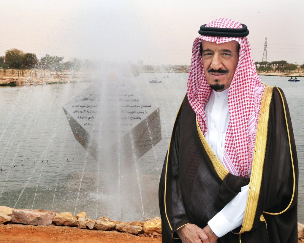
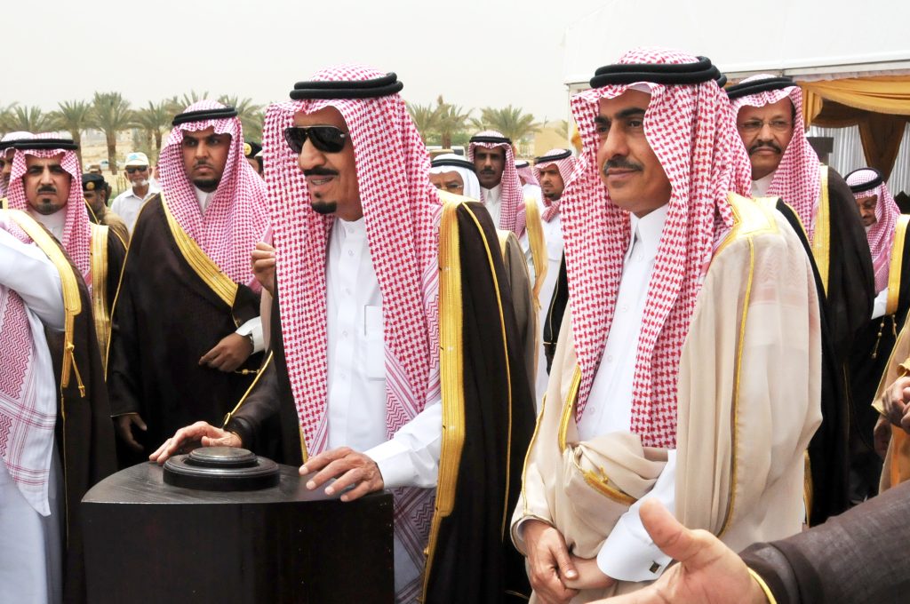
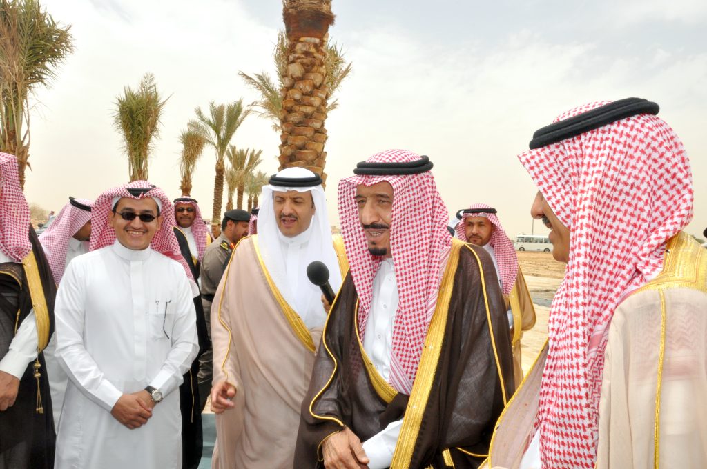
Project opening
On Rabi` al-Akhir 20, 1431 AH, the Custodian of the Two Holy Mosques King Salman bin Abdulaziz, then head of RCRC, sponsored the inauguration of the environmental rehabilitation project for Wadi Hanifa, following completion of the development works, inaugurating seven sites of the project, which included open parks and a station, the biological treatment station, and several lakes.